This article is part of a series about creating GPX files for South Korea’s Cross Country Cycle Route.
Here is the GPX file I generated by using the steps in this series. The file is publicly downloadable from this Google Drive link.
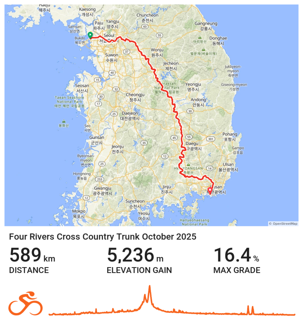
- The main trunk of South Korea’s Cross Country Cycle Route:
Four Rivers Cross Country Trunk October 2025 (GPX, 1.2 Mb). - The route does not cover the segments to Andong Dam nor to Chungdu Dam. I wasn’t planning to visit those places, and I wasn’t using the certification process for this ride.
The route is also available at RideWithGPS. You can view it there or download it in your preferred format (.fit, .tcx, .kml, .gpx).
Please do remember:
- There are many ways to construct bike routes using the named cycle paths. These routes reflected my intentions, and they may not suit everyone.
- You can make your own files using the techniques outlined in this series.
- This blog is not responsible for any harm you experience from your use of these files.